The combination of two extreme events, like heavy local precipitation and high surge levels, can have a more devastating impact than their single-hazard equivalents. Researchers from R & D Weather and Climate Models at KNMI shed light on atmospheric rivers, one of the mechanisms causing these "compound events".
The study shows that atmospheric rivers are a useful tool for early identification of possible harmful meteorological conditions over the Netherlands.
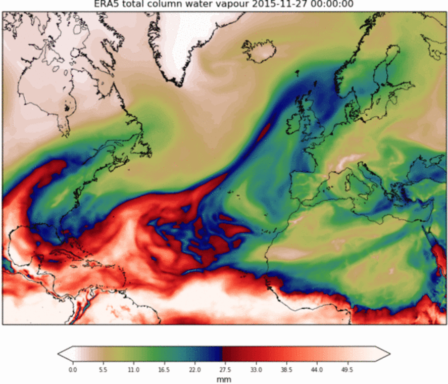
A solid understanding of the processes leading to a compound event, and their interactions, is crucial to understanding the future development of flood risk under a changing climate. Researchers at KNMI (Nina Ridder, Hylke de Vries, and Sybren Drijfhout) have focused on the large-scale climatic conditions leading to the simultaneous occurrence of heavy-duty and high-surge levels. In particular, they are focused on atmospheric rivers. An AR is a long, narrow regions or high water vapor content in the atmosphere that transports moisture to the high latitudes (Figure 1). When they reach land, ARs are often associated with heavy rainfall.Atmospheric rivers (AR) play a significant role in the simultaneous occurrence of high coastal water levels and heavy precipitation in the Netherlands.
"We find that the majority of compound event between 1979 and 2015 have been accompanied by the presence of atmospheric river across the Netherlands," says lead author Dr Nina Ridder.
The study shows that compound events have a 3 to 4 times higher chance of occurrence on an AR about the Netherlands compared to any random day. In contrast, AR 3 times is less likely than on any random day.
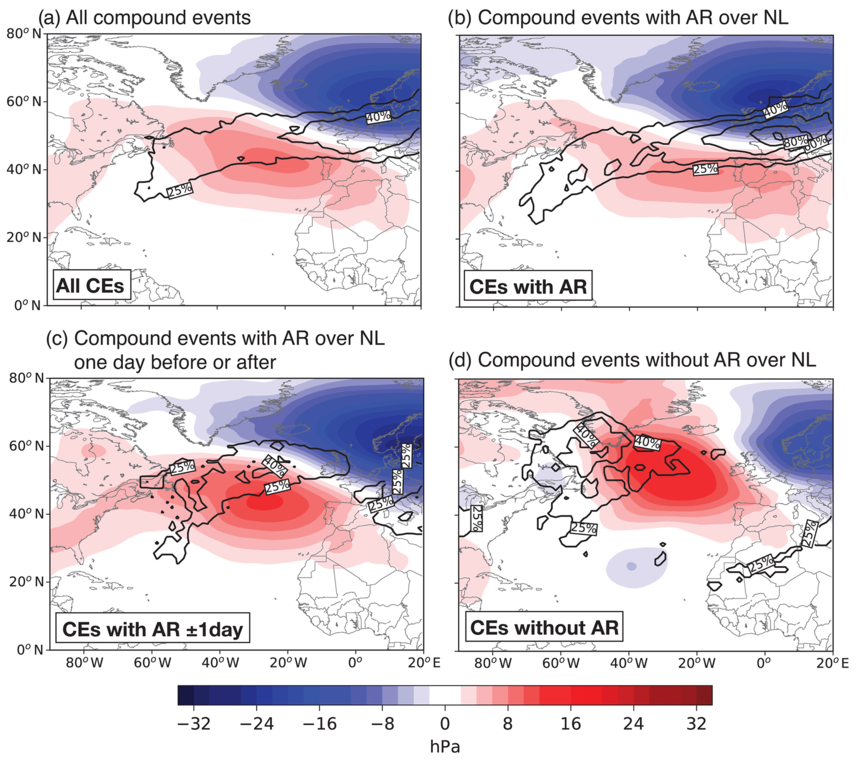
By isolating and assessing the prevailing sea level pressure (SLP) and sea surface temperature (SST) conditions with and without AR involvement up to 7 days before the events. that (i) resemble the SLP anomaly patterns during the positive phase of the North Atlantic Oscillation (NAO +) with a north-south pressure dipole over the North Atlantic (Figure 2b) and (ii) a North Atlantic subpolar gyre and eastern boundary upwelling zone while warming the western boundary of the North Atlantic. These conditions are clearly different from those during atmospheric river conditions. The east Atlantic pattern with a west-east pressure dipole on northern Europe and the West Atlantic (Figure 2d).
Ridder, N., de Vries, H., and Drijfhout, S. The role of atmospheric rivers in compound events consisting of heavy precipitation and high storm surges along the Dutch coast , Nat. Hazards Earth Syst. Sci., 18, 3311-3326, 2018.