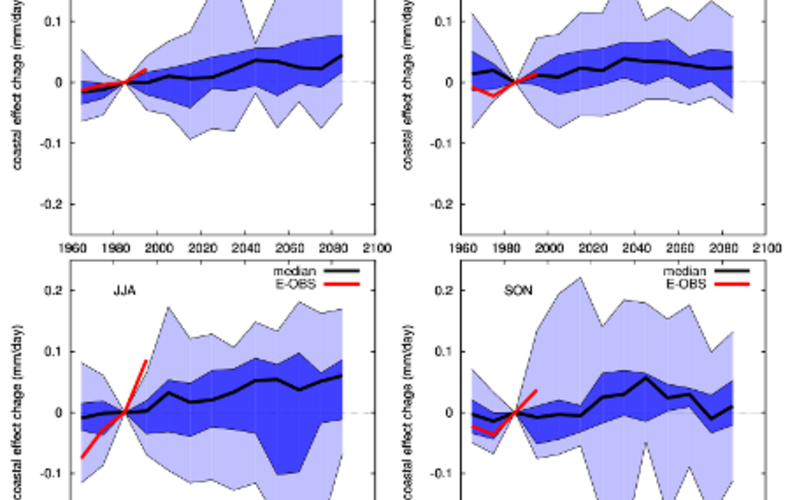
Climate change values in the KNMI’06 scenarios do not discriminate within the
Netherlands; thus changes in mean precipitation (and similarly, the wet-day
frequency, a precipitation extreme occurring once every 10 years, and also
temperature changes) are the same for the whole of the Netherlands for each of the
four scenarios, G, G+, W and W+. Spatial patterns seen in the climate in 2050 or
2100 are therefore entirely related to differences already present in the present-day
climate. One main reason for providing spatially uniform change values is that the
available model integrations at that time (mostly from the PRUDENCE project) had
an insufficient resolution of 50 km to be able to determine whether climate change
could be different within the Netherlands.
Recently, an ensemble of 19 regional climate integrations with an increased
resolution of 25 km has become available through the ENSEMBLES project [Hewitt
and Griggs (2004)]. These integrations are based on the A1B emission scenario and
run up to 2100. In this report we analyze this model ensemble and focus on mean
precipitation changes and the effect of the North Sea on differences in precipitation
between coastal and inland areas in the Netherlands.
JJ Attema, G Lenderink. Mean precipitation changes and coastal effects in the ENSEMBLES regional climate model simulations
KNMI number: WR-11-03, Year: 2011, Pages: 37